Monday, February 20, 2012

February Bluebirds

Eastern Bluebird, Charles River Peninsula, Needham, MA
The bluebirds have been active for a while now at the Charles River Peninsula.

Saturday morning I had six fly from a single tree. (A nice total for the GBBC, which flagged it for confirmation).
Today there were three in close proximity. Lots of vocalization.
And at least one couple seemed to have paired up. Have I already missed the courtship phase?

Sunday, February 19, 2012

A great morning at Eugene D. Moran Wildlife Management Area


View of Moran WMA from Fobes Hill, Windsor, MA
In the Berkshires overnight. Got up before dawn and arrived at Moran WMA just before sunrise. Northern shrike reported in the area. A nemesis bird.
A great area to visit in the winter. A thick walkable crust of snow with a new inch or so on top. Scrubby edge environment galore.
I started with Fobes Hill, still in shadow.
A dim glimpse of some sort of raptor. Size and shape of a merlin, but don't know for sure. Not much other activity. Moved on to the northern parking lot and started walking down the road. Immediately, familiar Zzzing sounds.

 Waxwings! A gazillion (I counted around 50) in a crab apple tree. Some robins in there too.
Cedar waxwing, Moran WMA, Windsor, MA
They let me get pretty close.
Cedar waxwing, Moran WMA, Windsor, MA
Good views of waxwing crab apple eating styles.

And when you see cedar waxwings in the winter, especially in a boreal-like habitat such as Moran WMA, who might also appear?
Bohemian waxwing, Moran WMA, Windsor, MA
Yes. Their bohemian cousin. Check out the red under-tail coverts.
Beaver dam on Windsor Brook
Given such a snow-less winter in Eastern Mass., it was a delight to see snow-scapes. I made it down to the beginning of the spruce forest before I ran out of time and had to turn back.
Spruce forest, Moran WMA, Windsor, MA
As I trudged through the snow on the way back, I spotted a large gray bird with an up-and-down flight pattern. It landed atop a small tree in the snow-covered meadow and flipped its tail. Well I'll be darned--the northern shrike.
Northern shrike (can't you tell?)
A nemesis bird, finally spotted. Not exactly a high-quality encounter, but an encounter nonetheless. A great morning at Moran WMA.

Wednesday, February 8, 2012

Ridge Hill Reservation: Muir Path Trail & Field View Trail

The last time I posted about the Muir Path Trail was about four years ago. At the time it was completely neglected, overgrown, and I basically had to hack my way through. Here's a photo. Now it is stunningly open, easy to walk, and a real Ridge Hill gem.
It circles a small pond. As I walked by recently I flushed a great horned owl. I wonder if there is a nest atop one of those tall white pines?
In fact the only downside is that the trail is short. If you come from the north you will reach a fork. Going to the left, which allows the clearest views of the pond, takes you back to the Ridge Hill driveway. Going to the right takes you to the gas line easement. It appears from the official map that you can simply follow the easement north to hook into other Ridge Hill trails.
Whether you do or not depends on how comfortable you are walking through someone's back yard...

The Field View Trail can be reached via the easement (in two spots: just north of the backyard above or just south of the spur off of North trail) as well as from the Ridge Hill field. (There is also access via a trail that begins just south of the picnic area).
Entrance to Field View Trail from the Ridge Hill field.
It is apparently named the "Field View" trail because you have to walk through a bit of field to get in. From the woods itself you will not be viewing any fields.
I think a better name might be the "swampy" trail, as the path is often muddy, running as it does through and along quite a bit of wetland. Note: this is not a knock against the trail. The wetland environment makes this area particularly birdy.
Old "You are entering private property" sign, slowly being consumed by tree.
Because of its many access points and the number of spurs leading in and out, the Field View Trail can be somewhat confusing to navigate. Of particular concern is the status of the easement. Is this private property or not? The signage may or may not be up to date.

I hope you have enjoyed this series of Ridge Hill posts. There is a meeting about the future of Ridge Hill on February 9 at the library starting at 7:15 p.m.

Monday, January 30, 2012

Ridge Hill Reservation: Esker, Swamp, Hornbeam trails

Esker Trail, Ridge Hill Reservation, Needham, MA
The main trail in Ridge Hill Reservation is the Esker Trail, which runs along the crest of an esker cutting through the property (this is the "ridge hill" in "Ridge Hill").  One can get to the entrance from the back parking lot if you walk east in the meadow along the edge of the woods.  It is a wide and high trail and I frankly find it a bit monotonous. It does provide access to a relatively deep part of the woods and, more importantly, a nice section of the Swamp Trail. It is where you are most likely to see pileated woodpeckers and ravens in the early morning and hear owls at dusk.

Almost immediately after the entrance the trail branches.
Esker trail on left, Hornbeam on right
Stay to the left. You can take the Hornbeam trail on the way back.

Soon on your left you will come to the eastern end of the Swamp Trail, a now impassable trail that theoretically connects the Esker Trail to the western trail complex.
If the weather is right (dry and/or cold) you can make it through a good portion of the trail without getting too muddy. Today I wore my muck boots so I fearless stomped my way in.
A mossy wonderland.
Mosses and lichens in many shapes and sizes. That's a delicate fern moss above, if I'm not mistaken.
Eventually you will reach the impassable bit and will have to turn back.

As you walk further north on the Esker Trail you can see the enormous mound that is the town landfill to the right. (And the Fuller Brook--unpictured--below it). Maybe you'll also see a hairy woodpecker (as I did today).
Fork at the end of the Esker Trail
 Eventually you will come to a fork, signaling the end of the Esker Trail. Which way should you go? Usually at this point I turn around and go back, but today I thought I would follow each path to its end. If you go to the left you will eventually come to this:
 If you go to the right you will quickly encounter another fork.
Going to the left gets you this
While going to the right actually gets you some interesting scenery
and then the trail just disappears.

So there is no real reason to keep going north after the end of the Esker Trail. [2014 Update: The Esker Trail has been extended--there is now a delightful loop at the end of it.] In fact you might be best off walking only as far as the second intersection with the Hornbeam Trail and making a loop of it.
The northern intersection with the Hornbeam Trail approaching from the south
The northern intersection of the Hornbeam Trail approaching from the north
The Hornbeam Trail runs parallel to the Esker Trail along the swampy lowland. There is a nice new boardwalk [courtesy of Girl Scouts] that makes the walk easier during muddier days.
If you, like me, believe that trails should be bordered by lichen-covered stone walls, the Hornbeam should not be missed.
Eventually you will come to a fork.
If you go to the right you will rejoin the Esker Trail and soon reach the exit. If you go to the left you will join the increasingly decrepit "Fit Trail."

Keep going past the pull-up bars (or do some pull-ups if you feel like it) and you will come to the edge of the old Nike Missile site, now the site of the brand new Needham Community Farm.
If you are allergic to bee stings you are advised to keep your distance.

It is an easy walk through the fit trail back out to the meadow.

Official trail maps can be downloaded from the Town of Needham website. Just remember that not all the trails on the map are passable at present. There is a meeting about the future of Ridge Hill, February 9, 2012 at 7:15 p.m. at the Needham Library.

Sunday, January 29, 2012

Ridge Hill Reservation: North Trail-Chestnut Trail loop

Sign at the Trail Head for North Trail at Ridge Hill Reservation
North Trail is the trail I usually take if I'm looking for a short "walk in the woods" at Ridge Hill. To get there you need to walk past the special event buildings and through the picnic area. Soon you will see a trail map (though right now this is still under construction).
As you walk north on North Trail there is a grove of tall white pine to the left.
 This is a great place to find pine warblers in the spring.

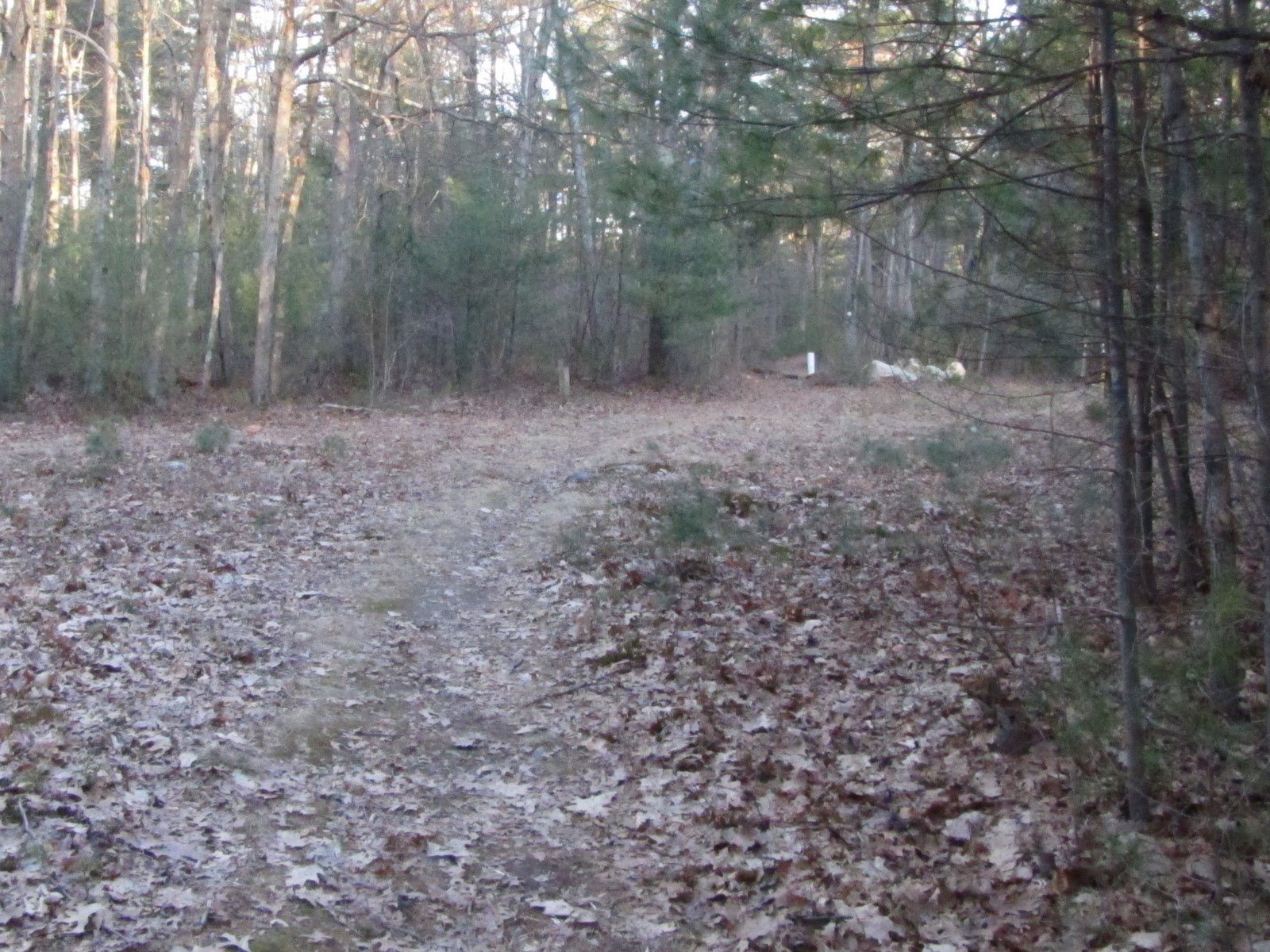
Soon you will see a fork in the trail.
Stay to the right. The trail to the left is unnamed (It offers a direct path to the Wellesley trail system.)

Very quickly you will see what remains of the "Drumlin Trail" to the left.
At present it is overgrown and a great place to pick up ticks. Avoid it. It rejoins the North Trail further on anyway.
Overgrown Drumlin Trail.
Soon you will come to the spot (on the right) where the Chestnut Trail joins the North Trail.
Chestnut Trail to the right
 Make a mental note of this spot. You can take the Chestnut Trail as an alternative route back.

Keep walking up the North Trail and eventually the trail will open onto a gas line easement.
Gas line easement. "Beard Trail" is across the way.
 This is officially the end of North Trail. Across the easement you will see a Wellesley Trail System arrow. This is "Beard Trail"--part of Ridge Hill but really more integrated with the Wellesley system. I usually continue walking north along the easement.
White-tailed deer getting to know one another.
I find the easement a great way to see and hear wildlife. White-tailed deer can be seen pretty consistently. Poachers (hunting is not allowed in Ridge Hill) know this too so it is best to wear orange during hunting season. Today I got to watch three deer (what I assume were young bucks post antlers) do a little dominance negotiation (ears down, tail to the side, some aggressive behavior). And then they saw me.
White-tailed deer, Ridge Hill Reservation, Needham, MA
 This is where I saw a weasel catch a rabbit a couple of years ago. Right now the chickadees are singing. Later in the spring you can hear warblers and wood thrush.

The easement can be pretty swampy the further north you walk. You will eventually come to a stream.
It is time to turn around.

Walk back to North Trail and this time on your way south you can take the Chestnut Trail.

Chestnut Trail to the left
Depending on the time of year the trail can be hard to see--last year it was obscured by the growth of young pine trees--so keep your eyes open.

At one point the Chestnut Trail was carefully managed as an educational nature walk. Here is a sample of the old signage on a precious relic from an earlier era of forestry--a genuine American Chestnut tree.
American Chestnut sign
Now the trail is in a bit of disrepair, with at least one large tree fall blocking the path. Even more discouraging is the "Swamp Trail, which branches off on the left when you are traveling south.
Swamp Trail (white trail marker)
The Swamp Trail used to connect the western trails with the major eastern trail, the "Esker Trail." No longer.
There used to be a boardwalk here.
Once during a winter cold snap I did manage (wearing rubber boots) to walk the former trail. But this trail is badly in need of an Eagle Scout boardwalk project. During the summer, needless to say, the mosquitoes make this area pretty unpleasant anyway.

If you continue to walk south on the Chestnut Trail (a great place to encounter scarlet tanagers in June) you will emerge behind the Ridge Hill Reservation garage, not far from the start of North Trail.

Official trail maps can be downloaded from the Town of Needham website. Just remember that not all the trails on the map are passable at present. There is a meeting about the future of Ridge Hill, February 9, 2012 at 7:15 p.m. at the Needham Library.